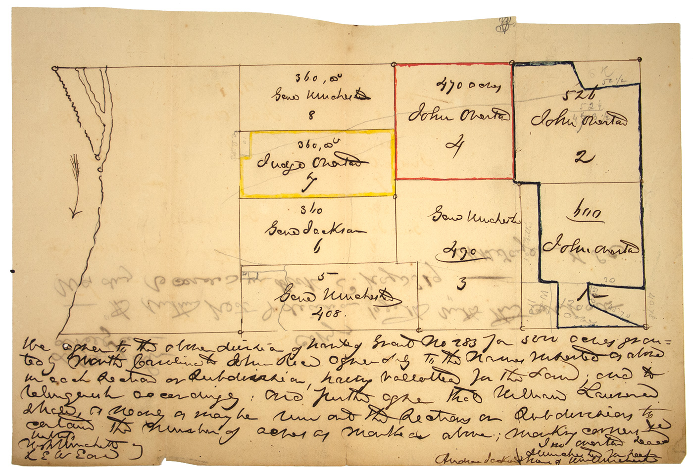
(Andrew Jackson and early Memphis, Tennessee) Manuscript map, 1p. 192 x 280 mm. (7 1/2 x 11 in.) Shelby County, Tenn [c. 1836] detailing divisions of a 5,000 acre tract of land in the the vicinity of the Mississippi river including a 360 acre plot assigned to “Genl” [Andrew] “Jackson”, several other plots are assigned to “Genl” [James] “Winchester” and “John Overton”.
The text below the survey identifies the tract as “Grant No. 283 for 5000 acres granted by North Carolina to John Rice.” That tract, located on the east bank of the Mississippi just below the mouth of the Wolf River, was purchased in 1783 by Rice from the State of North Carolina (which controlled the territory until 1790). When Rice died in 1791, his heirs sold the tract to John Overton in 1794 for $500. Overton divided the tract with his old friend, Andrew Jackson. Jackson subsequently divided his share with General James Winchester. This survey formally delineated the divisions, “agreeably to the name inserted above in each Section or Subdivisions; having balloted for the Same and to relinquish accordingly; And further agree that William Lawrence shall as nearly as may be run out the Section or Subdivisions to certain the number of acres as marked above…”
At the time of the original grant to Rice in 1783 and the subsequent divisions between Overton, Jackson and Winchester, the land was still under the control of the Chickasaw Indians, and there was little the trio could do to develop the land. In 1819, the Chickasaws ceded the territory, and the three lost no time in laying out a town on the banks of the Tennessee River.
The present survey concerns only 3,500 acres of the 5,000 acre tract and appears to denote the lands to the west of what would become the historic core of downtown Memphis. An arrow, denoting the flow of the river, points downwards and what appears to be Mud Island and the Wolf River Lagoon appear at the top left of the survey.
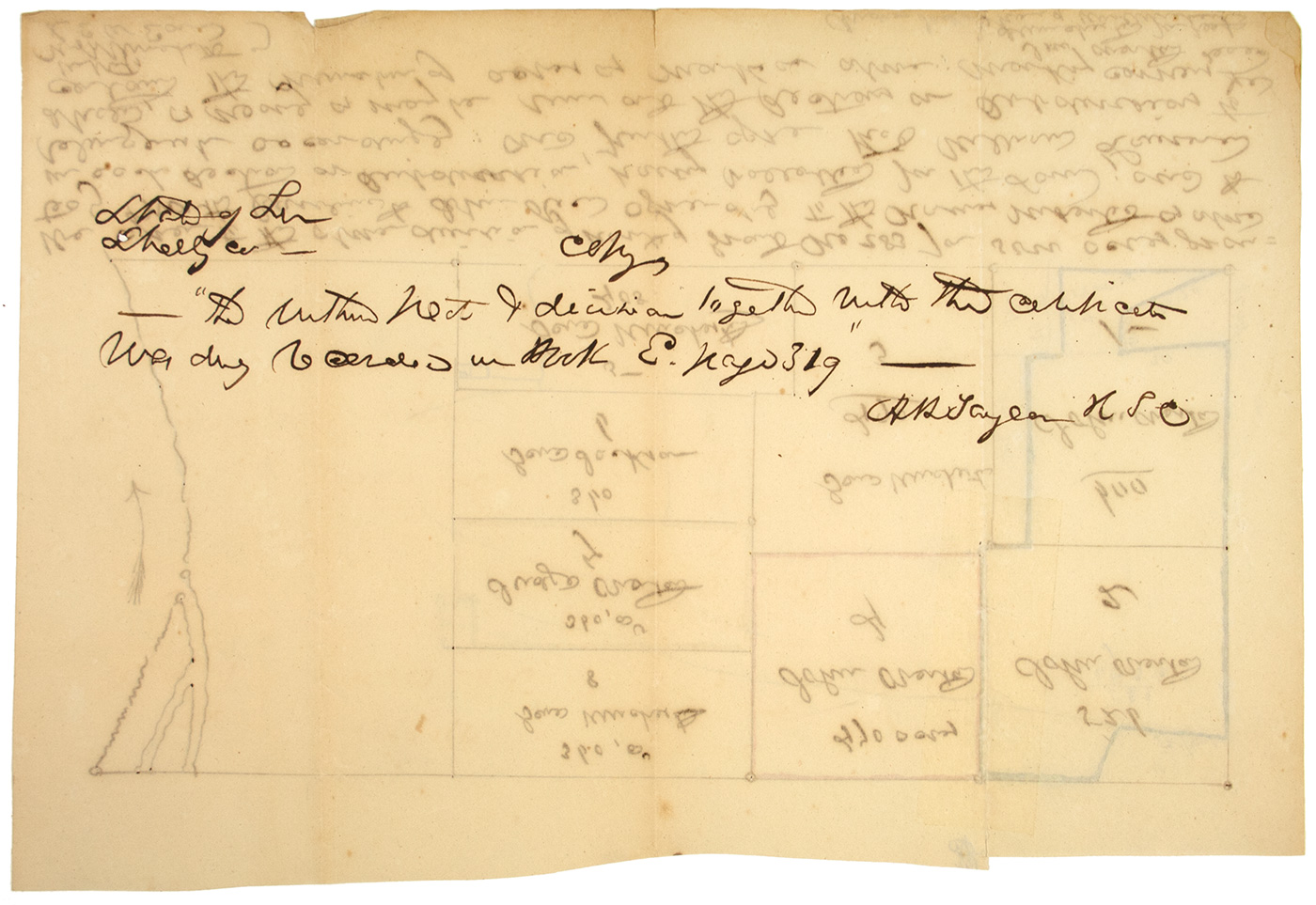
Endorsed on the verso as a true copy of the map. The map differs to some degree from the copy found in the Shelby County Archives in that small subdivisions were made amending the original ink sketch. All of the plots in question were assigned to John Overton.*
Uneven margins, a few light folds, else very good.
(EXA 5038) SOLD.
_____________
* Shelby County Register of Deeds, Book E, Page 319.