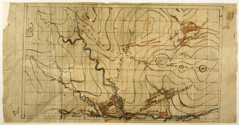
(Colorado Gold & Silver Mining) Manuscript map, ink on linen, 9 7/8 x 19 1/4 in. [n.d., c. 1865 – 1880] detailing mining claims in the Clear Creek Valley in the vicinity of Idaho Falls and Central City, Colorado. The map identifies approximately forty claims in the region, identified by red lines, which are mostly clustered around the Clear Creek tributaries of Mill Creek and Fall River. Towns identified on the map include Idaho Springs, Central City, Missouri City, and Mill City.Mine names include “St. Louis“, “Cristol“, “Seaton“, “Bales Lode“, “Geneva“, “Ohio“, “Harrisburg“, “Goldenburg“, “Bobtail Lode“. The map’s drafter was also planning to name more mines in the Central City vicinity, placing red lines in that region as well as the area known as Nevadaville.
Moderate toning with dampstain toward lower margin, small loss at upper right, very minor losses from ink erosion, overall very good.
(EXA 4491)
SOLD